



By Jack Mercer – Rabbit Hole Fisherman
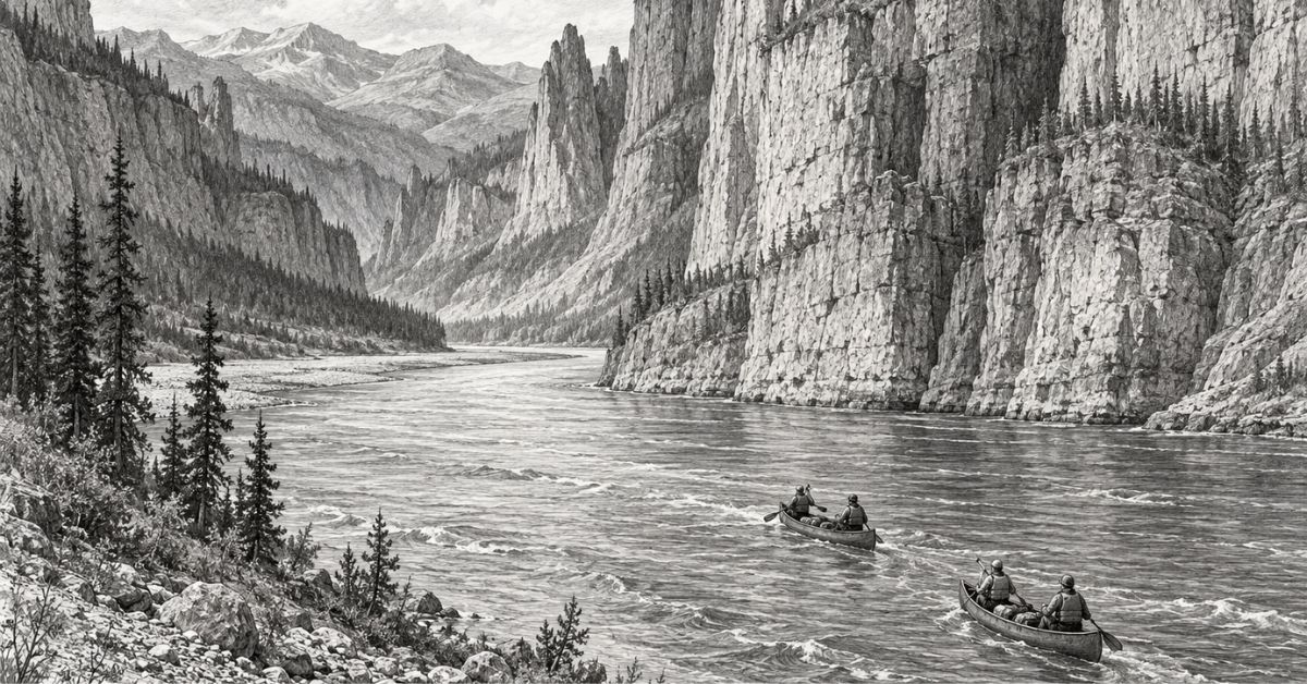
A floatplane delivers paddlers into Canada’s Northwest Territories, where the South Nahanni River cuts through mountain ranges that rose around its course. Beyond the enormous waterfall and the canyon walls is another story: generations of Dene families who knew this water as a route home.
In This Story
Getting there
The Nahanni makes you choose how much river you have time for before you get anywhere near a canoe.
Fly into Virginia Falls and the journey downstream usually takes seven to ten days. Start farther upstream at Rabbitkettle Lake and Parks Canada suggests ten to fourteen. There are longer options, reaching towards three weeks or more, for people whose annual leave permits a serious rearrangement of priorities. There are no public roads inside Nahanni National Park Reserve. Most visitors arrive by chartered floatplane.
That flight does something a road trip cannot quite manage. It separates the transport that brought you here from the transport that will take you through. Your destination is a stretch of water. After landing, progress will be measured in bends and campsites, with the contents of the boat accounting for rather more of your daily life than usual.
The South Nahanni lies in the southwest of Canada’s Northwest Territories. It rises near the Yukon border and runs for more than 500 kilometres before joining the Liard River near the community of Nahanni Butte. The park reserve around it covers about 30,050 square kilometres following a major expansion in 2009.
Upper river
There are several journeys within those dimensions. For this one, consider the two-week canoe route beginning at Gahnįhthah Mįe, Rabbitkettle Lake. Black Feather’s published Classic itinerary allows roughly three days of paddling before Náįlįcho, Virginia Falls. The gentler upper section gives a party time to practise before the more demanding water below.
It also delays the biggest spectacle. On a shorter trip, the falls can be the opening event; on this route, there is time to get used to the boat before reaching them. Both arrangements have their attractions. Some people want the headline act immediately. Others are quite happy to let the river work up to it.
At Rabbitkettle, even the ground needs an introduction. Thermal spring water carrying dissolved minerals has built tufa mounds, depositing calcium carbonate as it spreads across their surfaces. Parks Canada describes the North Mound as about 30 metres high and 60 metres wide. These formations are fragile, and visits to the mounds are restricted to guided walks with park staff.
Farther downstream, the scale of the erosion becomes difficult to take in from the seat of a canoe.
UNESCO describes the South Nahanni and Flat rivers as older than the mountains they dissect. As the land rose, the river systems kept eroding their way through it. The result is a passage through successive ranges, with rock walls enclosing water that had established its route before the mountains took their present form.
A map shows a line going through a mountain range. On the river, that line becomes the space your boat occupies. The geology is easier to pay attention to when it fills the view on either side.
People on the river
The familiar word “wilderness” describes the absence of roads reasonably well, but can leave a misleading impression about people.
Parks Canada records that, in the late nineteenth century, Mountain Dene families travelled down the Nahanni each spring in boats built from moose hides stretched over spruce frames. The boats carried families, dogs and the winter’s furs to trading posts. At the end of the voyage, they were dismantled and the hides traded. The return to the high country was overland, carrying what could be taken with pack dogs.
A visitor studying the capacity of a modern canoe can appreciate the practical intelligence in that arrangement. The boat was made using materials available in the mountains, did its work on the descent and had value when the trip was over. There was no need to arrange a freight service to send it upstream again.
That knowledge belongs to living communities. The park reserve overlaps the territories of several Indigenous peoples, whose use of its routes and harvesting areas continues. Its 2021 management plan puts Dene stories and knowledge at the centre of the visitor experience. A canoe holiday arrives within that history, even if the holidaymaker has only just learnt the river’s name.
In 2018, a group of Dene participants built a mooseskin boat and travelled the Nahanni for a project filmed as Nahanni: River of Forgiveness. The Northwest Territories government’s account describes Mountain Dene builders from Tulita working at Bunny Bar, upstream of Virginia Falls. Guides and filmmakers took part too.
Lawrence Nayally, one of the participants, later spoke to CBC Radio’s As It Happens about growing up with stories of his grandfather’s mooseskin-boat journeys. He described the expedition as a way of reconnecting with elders and ancestors. The boat went around Virginia Falls by helicopter, an update to the older overland portage.
The combination is worth holding in mind when the floatplane appears in a modern trip description. New machinery can help people travel a familiar river, including those returning to it for reasons far deeper than a holiday. There is no single correct date at which a place becomes authentic.
Virginia Falls
Eventually every downstream journey on this section has to deal with the falls.
Náįlįcho drops roughly 90 metres, with the flow divided by a large rock stack. Below it begins Fourth Canyon, followed downstream by Third, Second and First. The numbering makes more sense once you remember that a modern paddler travelling downriver is encountering them in reverse.
The falls themselves are walked around. Parks Canada describes the portage trail as steep and narrow, and limits camping at the falls to two nights to reduce congestion. A photograph of a canoe below that waterfall omits a fair amount of carrying.
This is where the romance of travelling with everything you need encounters the weight of everything you need. A sleeping bag is light enough on its own. Add food for the remaining days, cooking gear and a boat, and the collection becomes persuasive. Keeping dry things dry also becomes a continuing concern, rather than something settled once when the bags were bought.
Aimee Guile and Nathan Ensing offered a useful account of that less photogenic side in an interview published by Yellowknife outfitter Jackpine Paddle. Their self-guided trip took place in summer 2019. They prepared by taking a canoe expedition course with their group, practising strokes and rescues before travelling north to the Nahanni.
Nathan recalled finding the river bigger and faster than the water they had trained on. Aimee explained that starting at Rabbitkettle gave the group time to establish who was comfortable in the bow or stern before the rapids below the falls. Their account also includes the discovery that some of their breakfast supplies had been left at home. Park staff helped with extra food.
There is something usefully ordinary about that last admission. The expedition had required training and aircraft arrangements, yet a bag of breakfast could still be in the wrong building. The account is specific to their party and those conditions, not a promise that the river will be easy or that spare provisions will be available to the next group.
Below the portage
Below the portage, the character of the journey changes. Parks Canada describes Class II and III rapids, depending on water levels, and identifies a succession including Canyon Rapids, the Figure Eight Rapid at Hell’s Gate and Wrigley Whirlpool. The canoeing season is generally June to September, with conditions needing to be checked for the particular trip.
This route should only be attempted with current local briefings, appropriate whitewater experience, and up-to-date park conditions. Water levels, hazards and access arrangements can change quickly, and remote travel leaves little margin for guesswork.
The name “riffle” may sound modest to someone reading from an armchair. A loaded canoe gives the word more immediate interest. Paddlers have to keep working together while the current makes its own contribution, often a substantial one.
A raft offers another way through for travellers without the canoeing background. Nahanni River Adventures, for example, advertises a seven-day canyon trip starting at Virginia Falls, with beginners accepted for rafting while canoe participants need Class II whitewater experience. The distinction matters. Being able to join a professionally guided raft trip does not mean the same water is suitable for a first independent canoe outing.
The canyons give the lower journey its shape. At The Gate in Third Canyon, the river turns sharply through a gap beside a limestone wall Parks Canada puts at 460 metres high. Second Canyon leads into the calmer water of Deadmen Valley before First Canyon encloses the river again.
That alternation is part of the appeal. A wall is more impressive after an open view, and an open valley has a different effect after hours between walls. Travelling at water level lets the sequence take its time. A flight can show how the parts fit together, but a boat makes you spend a portion of your life between them.
Safety and distance
Off-river walks offer a change of muscles and perspective. They also bring their own decisions. Parks Canada warns of flash-flood potential in narrow tributary valleys and canyons. Its current hazard guidance specifically advises avoiding camping and hiking on the Clearwater Creek delta and immediately downstream. These are matters for current briefings and route planning, rather than deductions from a picturesque bend on a map.
The park’s overnight reservation and registration system is compulsory. Group size is limited to twelve, and the most popular period is 1 July to 15 August. Remote does not mean unadministered. It takes arrangements to keep a place like this available to small groups without turning its few landing sites and portages into queues.
The administration has also changed as Indigenous participation in governing the park has developed. In 2022, Canada, the Nahʔą Dehé Dene Band and Dehcho First Nations reached a shared-governance agreement, the Ndahecho Gondié Gháádé Agreement. The future of this river involves the people whose country it is as well as those hoping to visit.
For a traveller, that can affect the questions asked before choosing a trip. Who will explain the country being crossed? Is there time to listen as well as paddle? Black Feather’s published cultural rafting tour, for example, lists at least one Dene interpreter among its staff. Arrangements differ between departures and operators, so the answer should come from the people running the actual trip.
The lower river eventually opens out. Nahanni River Adventures describes leaving the canyons for the braided channels called the Splits. Its shorter itinerary uses a local powerboat for the final slow section towards Nahanni Butte, then an aircraft back to Fort Simpson. Other journeys make different arrangements. The end of the paddle and the end of the travelling are not necessarily the same appointment.
There is a pleasing reversal in that last flight. On the way in, the river is an aerial route to be imagined. On the way out, some of those bends have acquired associations: a landing place, a difficult stretch, the bank where the bags were unloaded. The view contains places you have spent time in.
For the Dene families who travelled downstream in mooseskin boats, dismantling the vessel once meant preparing for a long walk back into the mountains. The visiting canoeist has a much easier departure. Before climbing aboard, there is still the business of making sure every bag has reached the aircraft. Breakfast included.